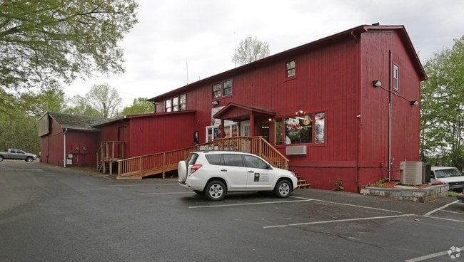
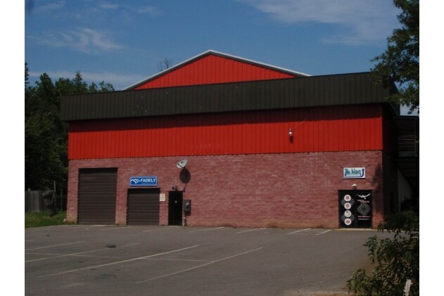
Property Record
5933 Plank Rd, Fredericksburg, VA 22407
NEARBY LISTINGS FOR SALE OR LEASE
Property Detail
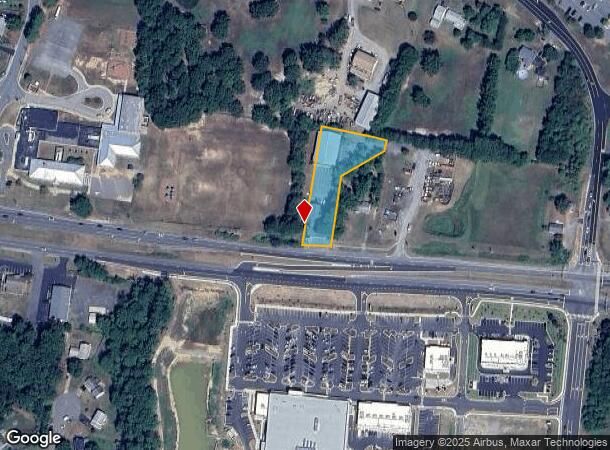
5933 Plank Rd
12B-A-1
Five Mile Acreage
Commercialnec
NR CHANCELLOR SCHOOL
X
Spotsylvania
51177C0100D
Virginia
2025
0.94 AC
2025
Spotsylvania County
020106
Washington, DC
5,890 SF
Washington-Arlington-Alexandria, DC-VA-MD-WV
DEMOGRAPHICS near 5933 Plank Rd
1 Mile
3 Mile
5 Mile
2024 Total Population
5,165
36,390
81,845
2029 Population
5,710
40,269
90,193
Pop Growth 2024-2029
+ 10.55%
+ 10.66%
+ 10.20%
Average Age
39
39
39
2024 Total Households
1,666
12,374
29,243
HH Growth 2024-2029
+ 10.56%
+ 10.72%
+ 10.26%
Median Household Inc
$115,138
$105,172
$97,613
Avg Household Size
3.00
2.90
2.70
2024 Avg HH Vehicles
3.00
2.00
2.00
Median Home Value
$356,768
$339,774
$355,697
Median Year Built
1995
1994
1995
Nearby Places
Map Layers
Map Styles
 Street
 Aerial
- Restaurants
- Banks
- Shops
- Fitness
- Groceries
PUBLIC TRANSPORTATION
COMMUTER RAIL
Fredericksburg (Fredericksburg Line - Virginia Railway Express)
DRIVE
WALK
Distance
Fredericksburg (Fredericksburg Line - Virginia Railway Express)
16 min
7.7 mi
Freight Ports
Virginia Port Authority - Richmond
DRIVE
WALK
Distance
Virginia Port Authority - Richmond
82 min
66.5 mi
SALE & LEASE HISTORY
LISTING DATE
SALE/LEASE

Sep 07, 2022
For Lease
Oct 07, 2025
For Lease
Jun 20, 2017
For Lease
Apr 18, 2017
For Sale
Nearby Properties
Address
Land Use
TOTAL SIZE
Lot Size
Zoning
Address
Land Use
TOTAL SIZE
Lot Size
Zoning
Address
Land Use
TOTAL SIZE
Lot Size
Zoning
24.82 AC
P4
Address
Land Use
TOTAL SIZE
Lot Size
Zoning
168,870 SF
13.11 AC
R2 - RESID
Address
Land Use
TOTAL SIZE
Lot Size
Zoning
88.70 AC
R1 - RESID
Address
Land Use
TOTAL SIZE
Lot Size
Zoning
11.11 AC
R2 - RESID
Address
Land Use
TOTAL SIZE
Lot Size
Zoning
70.23 AC
R1 - RESID
Address
Land Use
TOTAL SIZE
Lot Size
Zoning
103,971 SF
9.20 AC
C2 - COMME
Address
Land Use
TOTAL SIZE
Lot Size
Zoning
104.30 AC
RU - RURAL
Address
Land Use
TOTAL SIZE
Lot Size
Zoning
34,986 SF
13.78 AC
C2 - COMME
Address
Land Use
TOTAL SIZE
Lot Size
Zoning
122,904 SF
5.50 AC
R2 - RESID
Address
Land Use
TOTAL SIZE
Lot Size
Zoning
68,035 SF
7.46 AC
C3 - COMME
Address
Land Use
TOTAL SIZE
Lot Size
Zoning
48,009 SF
16.41 AC
Address
Land Use
TOTAL SIZE
Lot Size
Zoning
73,126 SF
7.43 AC
C3 - COMME
Address
Land Use
TOTAL SIZE
Lot Size
Zoning
115,571 SF
11.68 AC
C2 - COMME
Address
Land Use
TOTAL SIZE
Lot Size
Zoning
72.40 AC
R1 - RESID
Address
Land Use
TOTAL SIZE
Lot Size
Zoning
105,072 SF
12.35 AC
C3 - COMME
Address
Land Use
TOTAL SIZE
Lot Size
Zoning
16,700 SF
10.41 AC
C2 - COMME
Address
Land Use
TOTAL SIZE
Lot Size
Zoning
84,799 SF
4.12 AC
R2 - RESID
Address
Land Use
TOTAL SIZE
Lot Size
Zoning
58.60 AC
R1 - RESID
Address
Land Use
TOTAL SIZE
Lot Size
Zoning
103,729 SF
8.66 AC
C2 - COMME
Address
Land Use
TOTAL SIZE
Lot Size
Zoning
22,060 SF
3.29 AC
C2 - COMME
Address
Land Use
TOTAL SIZE
Lot Size
Zoning
59,818 SF
8.39 AC
C2 - COMME
Address
Land Use
TOTAL SIZE
Lot Size
Zoning
71,076 SF
3.62 AC
R2 - RESID
Address
Land Use
TOTAL SIZE
Lot Size
Zoning
14,630 SF
4.02 AC
R2 - RESID
Address
Land Use
TOTAL SIZE
Lot Size
Zoning
199,260 SF
5.65 AC
C2 - COMME
Address
Land Use
TOTAL SIZE
Lot Size
Zoning
95,790 SF
3.87 AC
C3 - COMME
Address
Land Use
TOTAL SIZE
Lot Size
Zoning
35,164 SF
4.17 AC
C3 - COMME
Address
Land Use
TOTAL SIZE
Lot Size
Zoning
64,076 SF
5.77 AC
C2 - COMME
Address
Land Use
TOTAL SIZE
Lot Size
Zoning
3,000 SF
3.62 AC
C2 - COMME
Address
Land Use
TOTAL SIZE
Lot Size
Zoning
15.90 AC
RU - RURAL
The World's #1 Commercial Real Estate Marketplace
Connect with us
© 2026 CoStar Group
The information above has been obtained from sources believed reliable. While we do not doubt its accuracy we have not verified it and make no guarantee, warranty or representation about it. It is your responsibility to independently confirm its accuracy and completeness. Any projections, opinions, assumptions, or estimates used are for example only and do not represent the current or future performance of the property. The value of this transaction to you depends on tax and other factors which should be evaluated by your tax, financial, and legal advisors. You and your advisors should conduct a careful, independent investigation of the property to determine to your satisfaction the suitability of the property for your needs.